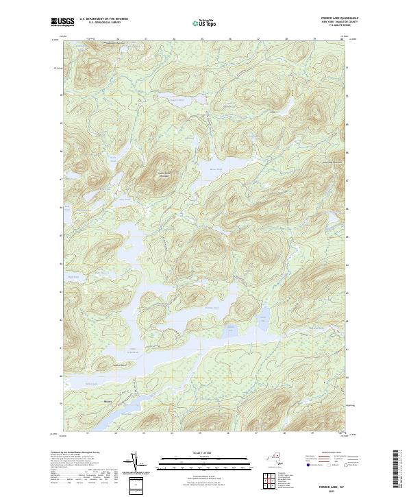
2023 Map of Forked Lake
USGS Topo · Published 2023About this map
Forked Lake and its intricate network of connecting waterways define this pocket of the Adirondacks, where the settlement of Woods sits at the southwestern shore. The landscape is characterized by a dense concentration of interior ponds and peaks, ranging from the heights of Antediluvian Mountain and Moose Pond Mountain to the remote waters of Flatfish Pond and Corner Pond. The hydrology is complex, with the Raquette River moving through Plumley Bay and North Bay, supported by smaller tributaries like Stony Brook and the Head Pond Outlet. Historical access and movement through the region are preserved in the naming of modern paths and roads such as the Forked Lake Carry Ln, while established footpaths like the Upper Sargent Pond Trl and Lower Sargent Pond Trl trace the land between the water bodies and the slopes of Owls Head Mountain.
Find a feature on this map
46 named features on this map. Tap any name to fly to it.
Don’t see what you’re looking for? This feature index may not catch every label — zoom into the map to look around manually.
Map Details
Editions of this 2023 Forked Lake Map
This is the sole edition of this map. No revisions or reprints were ever made.
Other maps of this area

1903 · Raquette Lake
USGS Topo · 1:62,500

1903 · Blue Mountain
USGS Topo · 1:62,500

1904 · Long Lake
USGS Topo · 1:62,500

1907 · Tupper Lake
USGS Topo · 1:62,500

1948 · Ogdensburg
USGS Topo · 1:250,000

1950 · Utica
USGS Topo · 1:250,000

1951 · Ogdensburg
USGS Topo · 1:250,000

1953 · Ogdensburg
USGS Topo · 1:250,000

1954 · Tupper Lake
USGS Topo · 1:62,500

1954 · Blue Mountain
USGS Topo · 1:62,500