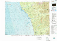
1988 Map of Forks
USGS Topo · Published 1988About this map
Forks serves as the primary hub for this coastal timber and river landscape, where the Soleduck River, Calawah River, and Bogachiel River converge. This 1988 topographic-bathymetric study provides a detailed view of the Olympic Peninsula's rugged western edge, from the heights of the Olympic Mountains down to the seafloor contours of the Pacific Ocean. The map documents significant land management boundaries, including the Olympic National Park and the Washington Islands National Wildlife Refuge, alongside the Quileute Indian Reservation at La Push and the Quinault Indian Reservation to the south. Notable maritime landmarks such as Destruction Island and James Island are detailed with bathymetric depth gradients. Further inland, the infrastructure of the forest economy and public land administration is visible through sites like the Snider Ranger Sta and Forks Municipal Airport.
Find a feature on this map
37 named features on this map. Tap any name to fly to it.
Don’t see what you’re looking for? This feature index may not catch every label — zoom into the map to look around manually.
Map Details
Editions of this 1988 Forks Map
This is the sole edition of this map. No revisions or reprints were ever made.
Other maps of this area

1918 · Lake Crescent
USGS Topo · 1:62,500

1921 · Quinault Lake
USGS Topo · 1:62,500

1922 · Pysht
USGS Topo · 1:62,500

1922 · Lake Crescent
USGS Topo · 1:62,500

1935 · Ozette Lake
USGS Topo · 1:62,500

1935 · Lake Pleasant
USGS Topo · 1:62,500

1939 · Forks
USGS Topo · 1:62,500

1939 · Mount Tom
USGS Topo · 1:62,500

1942 · Pysht
USGS Topo · 1:62,500

1942 · Ozette Lake
USGS Topo · 1:62,500