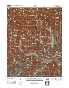
2011 Map of Forks of Buffalo
USGS Topo · Published 2011About this map
The confluence of the North Fork Buffalo River and South Fork Buffalo River forms the center of this Amherst County landscape, where the settlement of Forks of Buffalo sits at the junction of the waters. The terrain is defined by a series of prominent ridges and peaks, including Mount Pleasant and Turkey Mountain, which create a complex network of drainage basins for Horsley Creek and Puppy Creek. The land use appears split between the steep, forested elevations of the Blue Ridge and the more accessible valley floors where small communities like Sandidges and Allwood took root along the primary road corridors.
Find a feature on this map
65 named features on this map. Tap any name to fly to it.
Don’t see what you’re looking for? This feature index may not catch every label — zoom into the map to look around manually.
Map Details
Editions of this 2011 Forks of Buffalo Map
This is the sole edition of this map. No revisions or reprints were ever made.
Other maps of this area

1894 · Lexington
USGS Topo · 1:125,000

1932 · Lexington
USGS Topo · 1:48,000

1935 · Buena Vista
USGS Topo · 1:48,000

1935 · Amherst
USGS Topo · 1:48,000

1936 · Vesuvius
USGS Topo · 1:48,000

1937 · Lexington
USGS Topo · 1:62,500

1939 · Amherst
USGS Topo · 1:62,500

1939 · Buena Vista
USGS Topo · 1:62,500

1940 · Buena Vista
USGS Topo · 1:62,500

1941 · Vesuvius
USGS Topo · 1:62,500