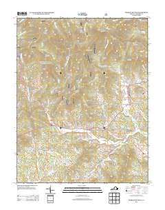
2013 Map of Forks of Buffalo
USGS Topo · Published 2013About this map
The Buffalo River serves as the central artery of this Amherst County landscape, where the confluence of the N Fork Buffalo River and S Fork Buffalo River defines the settlement of Forks of Buffalo. The terrain is shaped by numerous named ridges and peaks, including Buck Mountain, Turkey Mountain, and Mount Pleasant, which guide the path of early thoroughfares like the Lexington Tpke and Buffalo Springs Tpke. Smaller hamlets such as Sandidges, Allwood, and Willow are situated along these historic transport corridors, often near water sources like Thrashers Cr or the Thrasher Lake impoundment. The distribution of homes and rural roads, such as Emmanuel Church Rd and Sugar Hill Tunnel RD, reveals a settlement pattern deeply influenced by the narrow valleys and significant vertical relief of the Blue Ridge foothills.
Find a feature on this map
77 named features on this map. Tap any name to fly to it.
Don’t see what you’re looking for? This feature index may not catch every label — zoom into the map to look around manually.
Map Details
Editions of this 2013 Forks of Buffalo Map
This is the sole edition of this map. No revisions or reprints were ever made.
Other maps of this area

1894 · Lexington
USGS Topo · 1:125,000

1932 · Lexington
USGS Topo · 1:48,000

1935 · Buena Vista
USGS Topo · 1:48,000

1935 · Amherst
USGS Topo · 1:48,000

1936 · Vesuvius
USGS Topo · 1:48,000

1937 · Lexington
USGS Topo · 1:62,500

1939 · Amherst
USGS Topo · 1:62,500

1939 · Buena Vista
USGS Topo · 1:62,500

1940 · Buena Vista
USGS Topo · 1:62,500

1941 · Vesuvius
USGS Topo · 1:62,500