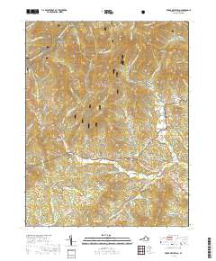
2019 Map of Forks of Buffalo
USGS Topo · Published 2019About this map
George Washington National Forest blankets the steep ridges and hollows of western Amherst County, where the Appalachian National Scenic Trail winds through Cowcamp Gap and past the historic Old Hotel. The landscape is defined by the convergence of mountain waters, specifically where the N Fork Buffalo River and S Fork Buffalo River meet to form the Buffalo River at the small community of Forks of Buffalo.
Find a feature on this map
82 named features on this map. Tap any name to fly to it.
Don’t see what you’re looking for? This feature index may not catch every label — zoom into the map to look around manually.
Map Details
Editions of this 2019 Forks of Buffalo Map
This is the sole edition of this map. No revisions or reprints were ever made.
Other maps of this area

1894 · Lexington
USGS Topo · 1:125,000

1932 · Lexington
USGS Topo · 1:48,000

1935 · Buena Vista
USGS Topo · 1:48,000

1935 · Amherst
USGS Topo · 1:48,000

1936 · Vesuvius
USGS Topo · 1:48,000

1937 · Lexington
USGS Topo · 1:62,500

1939 · Amherst
USGS Topo · 1:62,500

1939 · Buena Vista
USGS Topo · 1:62,500

1940 · Buena Vista
USGS Topo · 1:62,500

1941 · Vesuvius
USGS Topo · 1:62,500