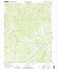
1963 Map of Forks of Buffalo
USGS Topo · Published 1990About this map
The Buffalo River serves as the central artery for this portion of Amherst County, where the transition from the George Washington National Forest to agricultural bottomlands is clearly defined. Settlement patterns follow the river's winding course, concentrated at small hubs like Forks of Buffalo and Sandidges. The local social fabric of the early 1960s is preserved through the locations of the Moss Rock Sch and a series of rural houses of worship including Mt Horeb Ch and Emmanuel Ch.
Find a feature on this map
69 named features on this map. Tap any name to fly to it.
Don’t see what you’re looking for? This feature index may not catch every label — zoom into the map to look around manually.
Map Details
Editions of this 1963 Forks of Buffalo Map
Other maps of this area

1894 · Lexington
USGS Topo · 1:125,000

1932 · Lexington
USGS Topo · 1:48,000

1935 · Buena Vista
USGS Topo · 1:48,000

1935 · Amherst
USGS Topo · 1:48,000

1936 · Vesuvius
USGS Topo · 1:48,000

1937 · Lexington
USGS Topo · 1:62,500

1939 · Amherst
USGS Topo · 1:62,500

1939 · Buena Vista
USGS Topo · 1:62,500

1940 · Buena Vista
USGS Topo · 1:62,500
1941 · Vesuvius
USGS Topo · 1:62,500