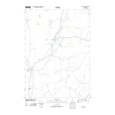
2010 Map of Fort Ann
USGS Topo · Published 2010About this map
Champlain Canal serves as the central artery for this section of Washington County, winding northward past Fort Ann and Comstock. The map documents a landscape defined by significant elevation changes, from the prominent Orebed Hill and The Pinnacle in the north to the historic terrain of Battle Hill overlooking the canal valley. This 2010 survey details a region where water management and transportation have long shaped settlement patterns, as seen in the collection of ponds such as Dolph Pond and Beaver Pond feeding into Halfway Creek. Genealogy researchers will find multiple burial sites preserved, including Welch Hollow Cemetery and Baker Cemetery. The map captures the interface between the low-lying Cedar Swamp and the surrounding high ground of Bull Hill, illustrating how the local road network, including Co Rd 17 and Ryder Rd, navigates the complex hydrology of the Winchell Creek basin.
Find a feature on this map
48 named features on this map. Tap any name to fly to it.
Don’t see what you’re looking for? This feature index may not catch every label — zoom into the map to look around manually.
Map Details
Editions of this 2010 Fort Ann Map
This is the sole edition of this map. No revisions or reprints were ever made.
Other maps of this area

1893 · Fort Ann
USGS Topo · 1:62,500

1893 · Whitehall
USGS Topo · 1:62,500

1895 · Whitehall
USGS Topo · 1:62,500

1895 · Fort Ann
USGS Topo · 1:62,500

1895 · Glens Falls
USGS Topo · 1:62,500

1897 · Bolton
USGS Topo · 1:62,500

1897 · Glens Falls
USGS Topo · 1:62,500

1898 · Whitehall
USGS Topo · 1:62,500

1898 · Fort Ann
USGS Topo · 1:62,500

1900 · Bolton
USGS Topo · 1:62,500