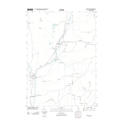
2013 Map of Fort Ann
USGS Topo · Published 2013About this map
The Champlain Canal serves as the dominant structural element of this Washington County landscape, cutting through the corridor between Comstock and Fort Ann. This modern survey illustrates the persistent importance of the waterway and its surrounding transport network, including the Deweys Bridge Road Bridge and the Clay Hill Road Bridge. Local genealogy interests are well-served by several clearly marked burial sites, from the Ft Ann Village Cem near the town center to the more isolated Welch Hollow Cem and Baker Cem.
Find a feature on this map
73 named features on this map. Tap any name to fly to it.
Don’t see what you’re looking for? This feature index may not catch every label — zoom into the map to look around manually.
Map Details
Editions of this 2013 Fort Ann Map
This is the sole edition of this map. No revisions or reprints were ever made.
Other maps of this area

1893 · Fort Ann
USGS Topo · 1:62,500

1893 · Whitehall
USGS Topo · 1:62,500

1895 · Whitehall
USGS Topo · 1:62,500

1895 · Fort Ann
USGS Topo · 1:62,500

1895 · Glens Falls
USGS Topo · 1:62,500

1897 · Bolton
USGS Topo · 1:62,500

1897 · Glens Falls
USGS Topo · 1:62,500

1898 · Whitehall
USGS Topo · 1:62,500

1898 · Fort Ann
USGS Topo · 1:62,500

1900 · Bolton
USGS Topo · 1:62,500