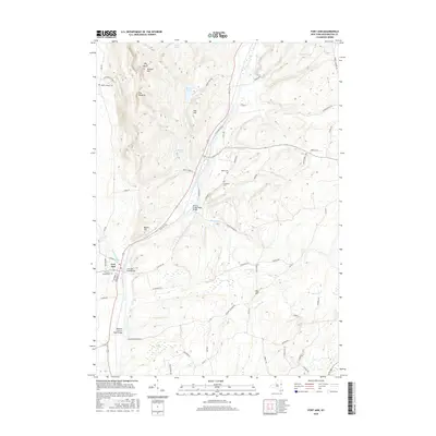
2016 Map of Fort Ann
USGS Topo · Published 2016About this map
Fort Ann serves as the focal point for this survey of the Washington County landscape, where the village and its nearby Fort Ann Village Cemetery sit just east of Kane Falls. The terrain is defined by significant elevations like Battle Hill and The Pinnacle, which rise above the surrounding valleys and wetlands. To the south and east, the drainage of Halfway Creek and Winchell Creek shapes the local topography, leading into the dense Cedar Swamp. This map highlights several historic crossings, including the Deweys Bridge Road Bridge and Baldwin Corners Road Bridge, which connect the rural road network through the hills. Genealogists will find interest in the dispersed burial grounds, such as Baker Cemetery and Comstock Cemetery, located along the winding secondary routes that bridge the gap between the higher peaks like Vail Hill and the waterways below.
Find a feature on this map
63 named features on this map. Tap any name to fly to it.
Don’t see what you’re looking for? This feature index may not catch every label — zoom into the map to look around manually.
Map Details
Editions of this 2016 Fort Ann Map
This is the sole edition of this map. No revisions or reprints were ever made.
Other maps of this area

1893 · Fort Ann
USGS Topo · 1:62,500

1893 · Whitehall
USGS Topo · 1:62,500

1895 · Whitehall
USGS Topo · 1:62,500

1895 · Fort Ann
USGS Topo · 1:62,500

1895 · Glens Falls
USGS Topo · 1:62,500

1897 · Bolton
USGS Topo · 1:62,500

1897 · Glens Falls
USGS Topo · 1:62,500

1898 · Whitehall
USGS Topo · 1:62,500

1898 · Fort Ann
USGS Topo · 1:62,500

1900 · Bolton
USGS Topo · 1:62,500