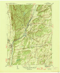
1946 Map of Fort Ann
USGS Topo · Published 1946About this map
Fort Ann and the surrounding Washington County landscape are defined by the convergence of industrial transport and difficult terrain in the mid-1940s. The Hudson Barge Canal and the Delaware and Hudson railroad run in close parallel through a narrow corridor, squeezed between the elevations of Battle Hill and Vail Hill. This infrastructure was the lifeline for settlements like Comstock and Baldwin Corner, facilitating movement through the valley while the surrounding heights remained sparsely settled. To the north, the terrain becomes more complex near Big Notch and Orebed Hill, where local history is etched into the landscape via remote landmarks like Welch Hollow Cem and Dolph Pond. The map reveals a post-war rural economy still centered on small nodes like Rathbunville, where the Rathbunville Sch served a localized community near the winding Winchell Creek.
Find a feature on this map
29 named features on this map. Tap any name to fly to it.
Don’t see what you’re looking for? This feature index may not catch every label — zoom into the map to look around manually.
Map Details
Editions of this 1946 Fort Ann Map
This is the sole edition of this map. No revisions or reprints were ever made.
Other maps of this area

1893 · Fort Ann
USGS Topo · 1:62,500

1893 · Whitehall
USGS Topo · 1:62,500

1895 · Whitehall
USGS Topo · 1:62,500

1895 · Fort Ann
USGS Topo · 1:62,500

1895 · Glens Falls
USGS Topo · 1:62,500

1897 · Bolton
USGS Topo · 1:62,500

1897 · Glens Falls
USGS Topo · 1:62,500

1898 · Whitehall
USGS Topo · 1:62,500

1898 · Fort Ann
USGS Topo · 1:62,500

1900 · Bolton
USGS Topo · 1:62,500