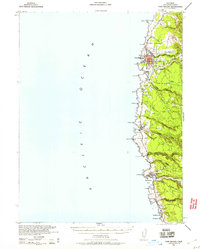
1943 Map of Fort Bragg
USGS Topo · Published 1960About this map
Fort Bragg serves as the industrial and population hub of this Mendocino coastline, where the Noyo River and Big River meet the Pacific Ocean. This 1943 survey, published during the war, reveals a landscape defined by timber and maritime commerce, with an extensive Railroad network reaching inland from the coast to support the local logging economy. Smaller coastal settlements like Noyo, Caspar, and Mendocino are connected by the primary north-south corridor, while the presence of a CCC Camp near Caspar Creek highlights the era's public works influence on the forest lands. From Cleone in the north to the mouth of Little River in the south, the map details the transition from rocky headlands like Laguna Pt and Cabrillo Pt to the complex gulches and creek drainages that dictated the placement of early roads and homesteads.
Find a feature on this map
44 named features on this map. Tap any name to fly to it.
Don’t see what you’re looking for? This feature index may not catch every label — zoom into the map to look around manually.
Map Details
Editions of this 1943 Fort Bragg Map
2 editions found
Other maps of this area

1920 · Glenblair
USGS Topo · 1:62,500

1920 · Fort Bragg
USGS Topo · 1:62,500

1921 · Westport
USGS Topo · 1:62,500

1921 · Branscomb
USGS Topo · 1:62,500

1943 · Glenblair
USGS Topo · 1:62,500

1943 · Fort Bragg
USGS Topo · 1:62,500

1943 · Albion
USGS Topo · 1:62,500

1943 · Navarro
USGS Topo · 1:62,500

1944 · Saddle Point
USGS Topo · 1:62,500

1950 · Cape Vizcaino
USGS Topo · 1:62,500