
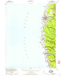
1943 Map of Fort Bragg
USGS Topo · Published 1943About this map
The rugged Mendocino coastline in the early 1940s is defined by its deep-water river mouths and timber heritage. At the northern end of the sheet, Fort Bragg serves as the primary urban center, while the Noyo River and Big River provide natural harbors for industry and transport. The interior landscape is marked by the Caspar South Fork Railroad, which follows the terrain of the southern gulches, illustrating the era’s reliance on rail to move resources toward the coastal mills and ports. Coastal settlements like Caspar, Mendocino, and the Heeser Addition are established alongside a string of coves and points, including Laguna Pt and Cabrillo Pt. Smaller hamlets like Pine Grove and Little River sit near the mouth of their respective namesake waters, connected by the burgeoning coastal road network and the inland Comptche Road.
Find a feature on this map
41 named features on this map. Tap any name to fly to it.
Don’t see what you’re looking for? This feature index may not catch every label — zoom into the map to look around manually.
Map Details
Editions of this 1943 Fort Bragg Map
2 editions found
Other maps of this area

1920 · Glenblair
USGS Topo · 1:62,500

1920 · Fort Bragg
USGS Topo · 1:62,500

1921 · Westport
USGS Topo · 1:62,500

1921 · Branscomb
USGS Topo · 1:62,500

1943 · Glenblair
USGS Topo · 1:62,500

1943 · Albion
USGS Topo · 1:62,500

1943 · Navarro
USGS Topo · 1:62,500

1944 · Saddle Point
USGS Topo · 1:62,500

1950 · Cape Vizcaino
USGS Topo · 1:62,500

1951 · Cape Vizcaino
USGS Topo · 1:62,500