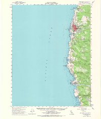
1960 Map of Fort Bragg
USGS Topo · Published 1967About this map
The coastal lumber town of Fort Bragg serves as the primary hub of this Mendocino County coastline survey, where the red-inked footprint of the settlement clusters near Noyo Bay. The landscape is defined by the proximity of the Pacific Ocean to the dense timberlands of the Jackson State Forest, which dominates the eastern half of the map. To the south, the village of Mendocino overlooks Mendocino Bay, while the smaller communities of Caspar and Little River dot the shoreline.
Find a feature on this map
52 named features on this map. Tap any name to fly to it.
Don’t see what you’re looking for? This feature index may not catch every label — zoom into the map to look around manually.
Map Details
Editions of this 1960 Fort Bragg Map
2 editions found
Other maps of this area

1920 · Glenblair
USGS Topo · 1:62,500

1920 · Fort Bragg
USGS Topo · 1:62,500

1921 · Westport
USGS Topo · 1:62,500

1921 · Branscomb
USGS Topo · 1:62,500

1943 · Glenblair
USGS Topo · 1:62,500

1943 · Fort Bragg
USGS Topo · 1:62,500

1943 · Albion
USGS Topo · 1:62,500

1943 · Navarro
USGS Topo · 1:62,500

1944 · Saddle Point
USGS Topo · 1:62,500

1950 · Cape Vizcaino
USGS Topo · 1:62,500