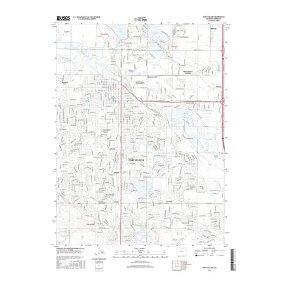
2016 Map of Fort Collins
USGS Topo · Published 2016About this map
The city of Fort Collins and its sprawling network of irrigation ditches and reservoirs define this 2016 survey of Larimer County. The landscape is a complex intersection of academic institutions and historical residential districts, anchored by the Colorado State University campus and various satellite education centers like Front Range Community College. To the north and east, established neighborhoods like Buckingham and Andersonville sit near the winding path of the Cache la Poudre River. The region's agricultural roots remain visible in the dense web of canals, including the Larimer and Weld Canal, Lake Canal, and the Josh Ames Ditch. While urban expansion has reached southern locales like McClellands and Harmony, the presence of numerous water bodies such as Terry Lake, Warren Lake, and Long Pond Reservoir continues to shape the city's modern layout and recreational space.
Find a feature on this map
72 named features on this map. Tap any name to fly to it.
Don’t see what you’re looking for? This feature index may not catch every label — zoom into the map to look around manually.
Map Details
Editions of this 2016 Fort Collins Map
This is the sole edition of this map. No revisions or reprints were ever made.
Other maps of this area

1902 · Greeley
USGS Topo · 1:125,000

1906 · Loveland
USGS Topo · 1:62,500

1906 · Fort Collins
USGS Topo · 1:62,500

1907 · Livermore
USGS Topo · 1:125,000

1908 · Loveland
USGS Topo · 1:62,500

1908 · Fort Collins
USGS Topo · 1:62,500

1908 · Eaton
USGS Topo · 1:125,000

1909 · Livermore
USGS Topo · 1:125,000

1910 · Eaton
USGS Topo · 1:125,000

1950 · Windsor
USGS Topo · 1:24,000