2022 Map of Fort Collins
USGS Topo · Published 2022About this map
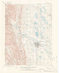
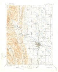
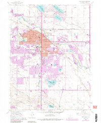
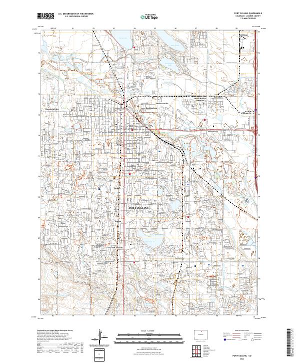
The Cache la Poudre River winds through this landscape, which is defined by an intricate network of irrigation ditches and canals established for the region's agricultural development. Historic neighborhoods like Buckingham and Andersonville sit along the riverbanks, reflecting the early settlement patterns of workers near the water. The expansive campus of Colorado State University and the Larimer County Justice Center anchor the civic core of Fort Collins. The surrounding area is marked by numerous water storage reservoirs and diversions, including Terry Lake, Warren Lake, and the Larimer and Weld Canal. This survey captures a complex intersection of academic growth, municipal expansion, and the enduring water-management infrastructure of the Colorado Front Range, evidenced by the many ditches like the Josh Ames Ditch and the New Mercer Ditch that weave through the residential blocks.
Find a feature on this map
69 named features on this map. Tap any name to fly to it.
Don’t see what you’re looking for? This feature index may not catch every label — zoom into the map to look around manually.
Map Details
Editions of this 2022 Fort Collins Map
This is the sole edition of this map. No revisions or reprints were ever made.
Historical Maps of Waterglen Through Time
5 maps found