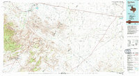
1985 Map of Fort Davis
USGS Topo · Published 1994About this map
Fort Davis National Historic Site and the surrounding high desert terrain anchor this mid-1980s topographic study of West Texas. The landscape is defined by the massive volcanic features of the Barrilla Mountains and the transition from the peaks of Davis Mountains State Park into the vast basins of the Augustine Flat. In the north, the irrigation-fed agriculture of the Balmorhea area contrasts with the arid canyonlands to the south.
Find a feature on this map
34 named features on this map. Tap any name to fly to it.
Don’t see what you’re looking for? This feature index may not catch every label — zoom into the map to look around manually.
Map Details
Editions of this 1985 Fort Davis Map
2 editions found
Other maps of this area

1894 · Valentine
USGS Topo · 1:125,000

1894 · Fort Davis
USGS Topo · 1:125,000

1895 · Marfa
USGS Topo · 1:125,000

1895 · Alpine
USGS Topo · 1:125,000

1897 · Valentine
USGS Topo · 1:125,000

1897 · Fort Davis
USGS Topo · 1:125,000

1920 · Longfellow
USGS Topo · 1:125,000

1921 · Toyah
USGS Topo · 1:125,000

1921 · Fort Stockton
USGS Topo · 1:62,500

1923 · Fort Stockton
USGS Topo · 1:62,500