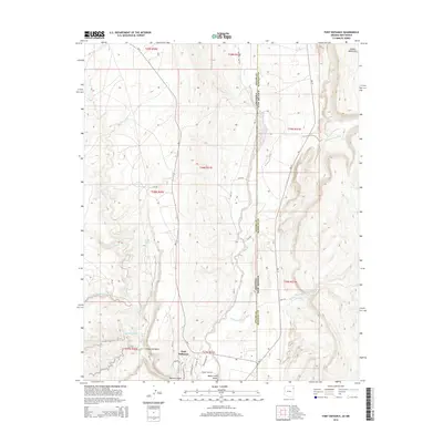
2014 Map of Fort Defiance
USGS Topo · Published 2014About this map
Fort Defiance sits at the convergence of rugged canyons and broad desert valleys along the border of Arizona and New Mexico. The landscape is dominated by the Black Creek Valley, where Black Creek flows southward flanked by Bureau of Indian Affairs routes like Bia-12 and Bia-112. To the northeast, the terrain rises sharply into the Chuska Mountains, while the western portion of the sheet is carved by complex drainages including Bonito Canyon and Meadow Wash.
Find a feature on this map
37 named features on this map. Tap any name to fly to it.
Don’t see what you’re looking for? This feature index may not catch every label — zoom into the map to look around manually.
Map Details
Editions of this 2014 Fort Defiance Map
This is the sole edition of this map. No revisions or reprints were ever made.
Other maps of this area

1886 · Wingate
USGS Topo · 1:250,000

1886 · Fort Defiance
USGS Topo · 1:250,000

1892 · Fort Defiance
USGS Topo · 1:250,000

1892 · Wingate
USGS Topo · 1:250,000

1954 · Gallup
USGS Topo · 1:250,000

1955 · Zith-Tusayan Butte 4 NW
USGS Topo · 1:24,000

1955 · Zith-Tusayan Butte 4 NE
USGS Topo · 1:24,000

1955 · Zith-Tusayan Butte 1 SE
USGS Topo · 1:24,000
1955 · Zith-Tusayan Butte 1 NE
USGS Topo · 1:24,000
1955 · Zith-Tusayan Butte 1 NW
USGS Topo · 1:24,000