
2022 Map of Fort Dodge South
USGS Topo · Published 2022About this map
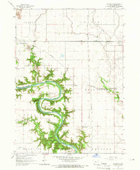
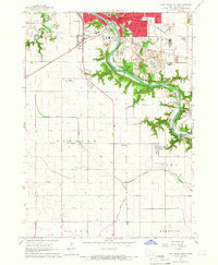
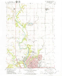
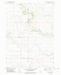
The Des Moines River carves a deep, winding path south from Fort Dodge, anchoring a landscape where industrial footprints meet agricultural order. This 2022 survey captures the transition from the city's southern neighborhoods and the Iowa Central Community College campus into the rural townships of Webster County. Long-established communities like Otho and Kalo sit along the river's eastern banks, while smaller settlements such as Shady Oak and Roberts dot the central plains.
Find a feature on this map
104 named features on this map. Tap any name to fly to it.
Don’t see what you’re looking for? This feature index may not catch every label — zoom into the map to look around manually.
Map Details
Editions of this 2022 Fort Dodge South Map
This is the sole edition of this map. No revisions or reprints were ever made.
Historical Maps of Douglas Township Through Time
8 maps found
Featured Locations
- Burnside Township, IA
- Cooper Township, IA
- Fort Dodge, IA
- Coalville, Pleasant Valley Township
- Otho, Otho Township