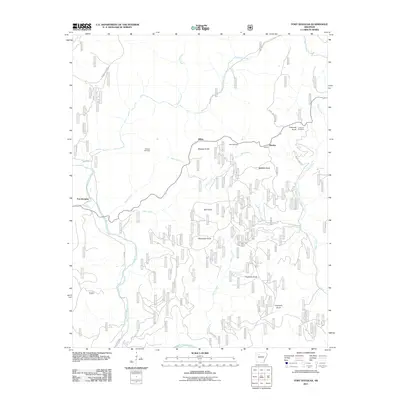
2011 Map of Fort Douglas
USGS Topo · Published 2011About this map
Fort Douglas and the surrounding rural landscape are defined by a complex network of waterways and prominent knobs. Big Piney Creek winds through the southwestern corner, joined by tributaries like Sugar Creek and Haw Creek, while Bear Creek cuts across the center of the quadrangle. The settlement pattern is sparse, with small communities such as Dillen and Bertha situated along the high ground and creek valleys.
Find a feature on this map
30 named features on this map. Tap any name to fly to it.
Don’t see what you’re looking for? This feature index may not catch every label — zoom into the map to look around manually.
Map Details
Editions of this 2011 Fort Douglas Map
This is the sole edition of this map. No revisions or reprints were ever made.
Other maps of this area

1889 · Treat
USGS Topo · 1:62,500

1889 · Ozone
USGS Topo · 1:62,500

1932 · Treat
USGS Topo · 1:62,500

1933 · Mt Judea
USGS Topo · 1:62,500

1934 · Treat
USGS Topo · 1:62,500

1934 · Ozone
USGS Topo · 1:62,500

1936 · Ozone
USGS Topo · 1:62,500

1940 · Mt Judea
USGS Topo · 1:62,500

1956 · Russellville
USGS Topo · 1:250,000

1964 · Russellville
USGS Topo · 1:250,000