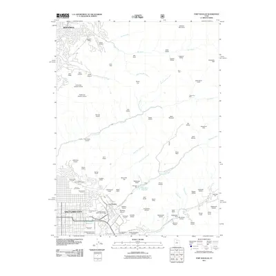
2011 Map of Fort Douglas
USGS Topo · Published 2011About this map
Salt Lake City and the historic grounds of Fort Douglas dominate the southwestern corner of this survey, where urban development meets the steep slopes of the Sessions Mountains. This map documents a dense concentration of local heritage sites, including the extensive Salt Lake City Cemetery and the University of Utah campus featuring the George S Eccles 2002 Legacy Bridge. To the east, the landscape transitions rapidly into a complex of canyons and gulches, such as City Creek Canyon and Emigration Canyon, where water sources like Red Butte Reservoir were essential for the growing city below. Higher elevations reveal the area's prospecting past with the Burro Mine and Treasure Box Mine tucked into the ridges. From the suburban edge of Bountiful in the northwest to the Hogle Zoological Gardens, the map illustrates how topography has dictated the expansion and recreational use of the Wasatch Front.
Find a feature on this map
95 named features on this map. Tap any name to fly to it.
Don’t see what you’re looking for? This feature index may not catch every label — zoom into the map to look around manually.
Map Details
Editions of this 2011 Fort Douglas Map
This is the sole edition of this map. No revisions or reprints were ever made.
Other maps of this area

1885 · Salt Lake
USGS Topo · 1:250,000

1925 · Ft. Douglas
USGS Topo · 1:125,000

1928 · Ft. Douglas
USGS Topo · 1:125,000

1950 · Fort Douglas
USGS Topo · 1:24,000

1951 · Fort Douglas
USGS Topo · 1:24,000

1951 · Salt Lake City South
USGS Topo · 1:24,000

1951 · Salt Lake City North
USGS Topo · 1:24,000

1952 · Sugar House
USGS Topo · 1:24,000

1952 · Farmington
USGS Topo · 1:24,000

1952 · Bountiful Peak
USGS Topo · 1:24,000