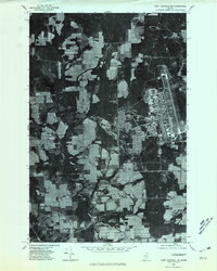
1975 Map of Fort Fairfield NW
USGS Topo · Published 1981About this map
Madawaska River and its tributary, the Little Madawaska River, define the hydraulic character of this Aroostook County landscape during the mid-1970s. This orthophoto quadrangle reveals a patchwork of intensive agricultural fields and woodlots, a hallmark of the region's potato-farming heritage. The imagery captures the structured layout of the area as it appeared when aerial photography was taken in 1975, showing the clear delineation between cultivated land and the dense forest surrounding Butterfield Lake. Small rural intersections like Brown Corner and Somers Corner serve as the primary local landmarks, marking the junctions of farm-to-market roads. Smaller watercourses such as Greenlaw Brook and Otter Brook cut through the fields, illustrating the natural drainage patterns that have long dictated the placement of homesteads and crop rows in this northern Maine borderland.
Find a feature on this map
7 named features on this map. Tap any name to fly to it.
Don’t see what you’re looking for? This feature index may not catch every label — zoom into the map to look around manually.
Map Details
Editions of this 1975 Fort Fairfield NW Map
This is the sole edition of this map. No revisions or reprints were ever made.
Other maps of this area

1921 · Van Buren
USGS Topo · 1:250,000

1927 · Stockholm
USGS Topo · 1:48,000

1929 · Caribou
USGS Topo · 1:48,000

1930 · Fort Fairfield
USGS Topo · 1:48,000

1931 · Van Buren
USGS Topo · 1:48,000

1931 · Stockholm
USGS Topo · 1:62,500

1932 · Caribou
USGS Topo · 1:62,500

1933 · Fort Fairfield
USGS Topo · 1:62,500

1934 · Van Buren
USGS Topo · 1:62,500

1951 · Van Buren
USGS Topo · 1:62,500