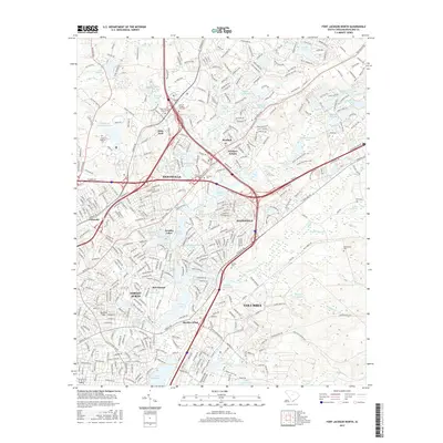
2017 Map of Fort Jackson North
USGS Topo · Published 2017About this map
Forest Acres and the surrounding suburbs of Columbia dominate this 2017 landscape, revealing the intricate water systems and established residential patterns of South Carolina's capital region. The terrain is defined by numerous man-made and natural water bodies, including the expansive Sesqui Lake and the smaller Alcohol and Drug Abuse Lake, which underscore the region's managed environmental character. A clear spatial record of the area's institutional history is preserved through labels like the State Hospital Cem and State Park, while the presence of Bethel Church and the Macedonia Cem provides grounding for local genealogical research.
Find a feature on this map
422 named features on this map. Tap any name to fly to it.
Don’t see what you’re looking for? This feature index may not catch every label — zoom into the map to look around manually.
Map Details
Editions of this 2017 Fort Jackson North Map
This is the sole edition of this map. No revisions or reprints were ever made.
Other maps of this area

1904 · Columbia
USGS Topo · 1:125,000

1935 · Killian
USGS Topo · 1:48,000

1937 · Killian
USGS Topo · 1:62,500

1941 · Spartanburg
USGS Topo · 1:250,000

1942 · Camden
USGS Topo · 1:125,000

1944 · Edmund
USGS Topo · 1:62,500

1947 · Columbia North
USGS Topo · 1:24,000

1948 · Hopkins
USGS Topo · 1:62,500

1948 · Columbia North
USGS Topo · 1:24,000

1949 · Irmo NE
USGS Topo · 1:24,000