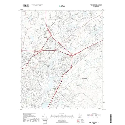
2020 Map of Fort Jackson North
USGS Topo · Published 2020About this map
Dentsville and Woodfield anchor this residential and commercial landscape northeast of Columbia as it appeared in 2020. The area is defined by a dense network of suburban developments such as Forest Acres, Arcadia Lakes, and Windsor Estates, interspersed with numerous private and public water bodies. State Park and the adjacent Sesquicentennial Pond provide significant green space amidst the expanding infrastructure of the I-20 and I-77 corridors. Significant historical sites, including the State Hospital Cem, Beulah Cem, and Macedonia Cem, are preserved within the modern street grid. The drainage of Crane Cr and Jackson Cr feeds a series of reservoirs like Lake Katherine and Forest Lake, illustrating how the region's natural hydrology has been integrated into its 21st-century suburban footprint.
Find a feature on this map
57 named features on this map. Tap any name to fly to it.
Don’t see what you’re looking for? This feature index may not catch every label — zoom into the map to look around manually.
Map Details
Editions of this 2020 Fort Jackson North Map
This is the sole edition of this map. No revisions or reprints were ever made.
Other maps of this area

1904 · Columbia
USGS Topo · 1:125,000

1935 · Killian
USGS Topo · 1:48,000

1937 · Killian
USGS Topo · 1:62,500

1941 · Spartanburg
USGS Topo · 1:250,000

1942 · Camden
USGS Topo · 1:125,000

1944 · Edmund
USGS Topo · 1:62,500

1947 · Columbia North
USGS Topo · 1:24,000

1948 · Hopkins
USGS Topo · 1:62,500

1948 · Columbia North
USGS Topo · 1:24,000

1949 · Irmo NE
USGS Topo · 1:24,000