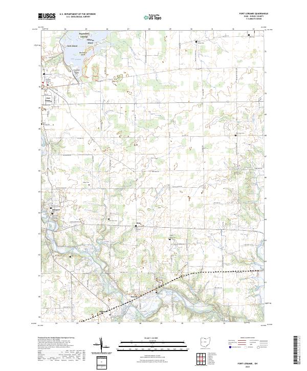
2023 Map of Fort Loramie
USGS Topo · Published 2023About this map
Lake Loramie serves as the focal point for this section of Shelby County, where a complex network of islands including Filburns Island, Blackberry Island, and Crawford Island define the northern water landscape. The surrounding terrain is heavily influenced by agricultural drainage patterns, evidenced by numerous named waterways like Ellerman Ditch and Gaier Ditch that feed into the larger Loramie Creek system. This area is characterized by a high density of religious and commemorative sites, from Old Saint Michaels Cem near the historic hub of Fort Loramie to the Saint Peter and Saint Paul Cem in Newport. Modern recreational infrastructure is also present, with the North Country National Scenic Trl winding through the southern portion of the map near Dawson, tracing the corridor between Houston and the creek. The settlement pattern follows a traditional township grid, connecting small communities such as Oran via a series of county and township roads.
Find a feature on this map
78 named features on this map. Tap any name to fly to it.
Don’t see what you’re looking for? This feature index may not catch every label — zoom into the map to look around manually.
Map Details
Editions of this 2023 Fort Loramie Map
This is the sole edition of this map. No revisions or reprints were ever made.