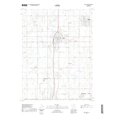
2019 Map of Fort Lupton
USGS Topo · Published 2019About this map
The South Platte River valley defines this portion of Weld County, serving as a corridor for both historical agriculture and modern infrastructure. The city of Fort Lupton serves as a central hub, surrounded by smaller residential pockets and settlements like Wattenberg, Aristocrat Ranchettes, and Lochbuie. The landscape is heavily shaped by an extensive network of irrigation systems, including the Fulton Ditch, Brantner Ditch, and Brighton Ditch, which support the region's agricultural character and lead to various impoundments such as the H A Smith Reservoir.
Find a feature on this map
90 named features on this map. Tap any name to fly to it.
Don’t see what you’re looking for? This feature index may not catch every label — zoom into the map to look around manually.
Map Details
Editions of this 2019 Fort Lupton Map
This is the sole edition of this map. No revisions or reprints were ever made.
Other maps of this area

1890 · East Denver
USGS Topo · 1:125,000

1902 · Greeley
USGS Topo · 1:125,000

1940 · Brighton
USGS Topo · 1:31,680

1940 · Eastlake
USGS Topo · 1:31,680

1942 · Mile High Lakes
USGS Topo · 1:31,680

1944 · Brighton
USGS Topo · 1:31,680

1944 · Eastlake
USGS Topo · 1:31,680

1949 · Gowanda
USGS Topo · 1:24,000

1949 · Fort Lupton
USGS Topo · 1:24,000

1949 · Platteville
USGS Topo · 1:24,000