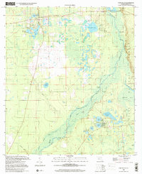
1999 Map of Fort Mc Coy
USGS Topo · Published 2001About this map
The Ocklawaha River snakes through the heart of this North Central Florida landscape, defining a labyrinth of wetlands and riverine landings within the Ocala National Forest. At the turn of the millennium, the area around Fort McCoy and Eureka remains characterized by its complex hydrology, where numerous named water bodies like Graveyard Lake, McQuaig Lake, and Silver Lake dot the sandy terrain. The map captures a network of specialized access points including Osceola Landing, Gores Landing, and Parch Landing, reflecting the area's long-standing reliance on the river for transport and recreation.
Find a feature on this map
42 named features on this map. Tap any name to fly to it.
Don’t see what you’re looking for? This feature index may not catch every label — zoom into the map to look around manually.
Map Details
Editions of this 1999 Fort Mc Coy Map
This is the sole edition of this map. No revisions or reprints were ever made.
Other maps of this area

1893 · Citra
USGS Topo · 1:62,500

1895 · Citra
USGS Topo · 1:62,500

1895 · Ocala
USGS Topo · 1:62,500

1954 · Gainesville
USGS Topo · 1:250,000

1954 · Daytona Beach
USGS Topo · 1:250,000

1958 · Daytona Beach
USGS Topo · 1:250,000

1958 · Gainesville
USGS Topo · 1:250,000

1959 · Gainesville
USGS Topo · 1:250,000

1964 · Daytona Beach
USGS Topo · 1:250,000
1967 · Citra
USGS Topo · 1:24,000