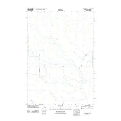
2012 Map of Fort Meade SE
USGS Topo · Published 2012About this map
Pleasant Valley Cr and Morris Cr wind through this part of Meade County, South Dakota, defining a landscape marked by ranch roads and seasonal drainages. This 2012 survey shows the rural character of the region just east of the Black Hills, where land use is structured around established routes like Pleasant Valley Rd and Tilford Rd. The drainage patterns of Antelope Cr in the northeast corner highlight the local hydrology. The map provides a clear look at the modern road network, including residential spurs such as Falcon Pl and Eagle Ridge Rd, illustrating the intersection of traditional agricultural land and modern rural development.
Find a feature on this map
14 named features on this map. Tap any name to fly to it.
Don’t see what you’re looking for? This feature index may not catch every label — zoom into the map to look around manually.
Map Details
Editions of this 2012 Fort Meade SE Map
This is the sole edition of this map. No revisions or reprints were ever made.
Other maps of this area

1893 · Rapid
USGS Topo · 1:125,000

1898 · Rapid
USGS Topo · 1:125,000

1903 · Rapid
USGS Topo · 1:125,000

1953 · Rapid City 1 SW
USGS Topo · 1:24,000

1953 · Rapid City 1 NW
USGS Topo · 1:24,000

1953 · Blackhawk
USGS Topo · 1:24,000

1953 · Piedmont
USGS Topo · 1:24,000
1953 · Fort Meade
USGS Topo · 1:24,000

1953 · Rapid City NW
USGS Topo · 1:24,000
1953 · Tilford
USGS Topo · 1:24,000