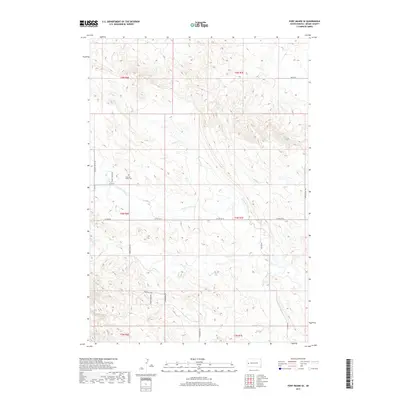
2017 Map of Fort Meade SE
USGS Topo · Published 2017About this map
Pleasant Valley Cem serves as a central landmark in this portion of Meade County, situated near the headwaters of Pleasant Valley Cr. The landscape is defined by the drainage patterns of several small waterways, including Antelope Cr and Morris Cr, which carve through the terrain. A network of rural routes and residential developments like Frontier Loop and Northwood Dr indicates modern residential expansion into the hills. The map illustrates a transition from larger undeveloped parcels to more subdivided residential tracts, particularly visible along Pleasant Valley Rd and Middle Alkali Rd. These infrastructure changes, including the presence of Stoney Creek Trl and Tilford Rd, reflect the contemporary layout of this rural community as it appeared in the late 2010s.
Find a feature on this map
24 named features on this map. Tap any name to fly to it.
Don’t see what you’re looking for? This feature index may not catch every label — zoom into the map to look around manually.
Map Details
Editions of this 2017 Fort Meade SE Map
This is the sole edition of this map. No revisions or reprints were ever made.
Other maps of this area

1893 · Rapid
USGS Topo · 1:125,000

1898 · Rapid
USGS Topo · 1:125,000

1903 · Rapid
USGS Topo · 1:125,000

1953 · Rapid City 1 SW
USGS Topo · 1:24,000

1953 · Rapid City 1 NW
USGS Topo · 1:24,000

1953 · Blackhawk
USGS Topo · 1:24,000

1953 · Piedmont
USGS Topo · 1:24,000
1953 · Fort Meade
USGS Topo · 1:24,000

1953 · Rapid City NW
USGS Topo · 1:24,000
1953 · Tilford
USGS Topo · 1:24,000