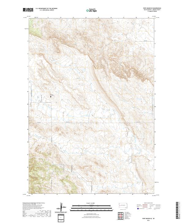
2021 Map of Fort Meade SE
USGS Topo · Published 2021About this map
Pleasant Valley Cem stands as a central local landmark in this part of Meade County, situated near the headwaters of several drainage systems. The landscape is defined by the winding paths of Pleasant Valley Cr and Antelope Cr, which carve through the terrain as it transitions between different township ranges. This modern survey reflects the rural residential layout of the area, where local transit is facilitated by a network of named routes such as Pleasant Valley Rd, Stoney Creek Trl, and Tilford Rd. To the south, Morris Cr flows through the landscape, mirrored by the development along Morris Creek Pl. The map provides a precise look at property divisions and rural infrastructure, including secondary highways like Co Hwy MC-8 that connect these remote hills and valleys.
Find a feature on this map
25 named features on this map. Tap any name to fly to it.
Don’t see what you’re looking for? This feature index may not catch every label — zoom into the map to look around manually.
Map Details
Editions of this 2021 Fort Meade SE Map
This is the sole edition of this map. No revisions or reprints were ever made.
Other maps of this area

1893 · Rapid
USGS Topo · 1:125,000

1898 · Rapid
USGS Topo · 1:125,000

1903 · Rapid
USGS Topo · 1:125,000

1953 · Rapid City 1 SW
USGS Topo · 1:24,000

1953 · Rapid City 1 NW
USGS Topo · 1:24,000

1953 · Blackhawk
USGS Topo · 1:24,000

1953 · Piedmont
USGS Topo · 1:24,000
1953 · Fort Meade
USGS Topo · 1:24,000

1953 · Rapid City NW
USGS Topo · 1:24,000
1953 · Tilford
USGS Topo · 1:24,000