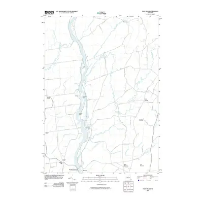
2010 Map of Fort Miller
USGS Topo · Published 2010About this map
The Hudson River defines the central spine of this landscape, separating the riverfront hamlets of Fort Miller and Northumberland. To the south, the village of Thomson sits near the river banks, while the interior is marked by a network of rural crossroads and agricultural clusters like Jewell Corner, Callahans Corners, and Durkeetown. Genealogical interest is found at the Bacon Hill Cemetery and Thompson Cemetery, which serve the long-established farming communities across the upland plateaus. The topography shifts from the river bottomlands to the prominent elevations of Gavettes Mountain and Bald Mountain in the southeast. Numerous waterways, including the winding Moses Kill, Snook Kill, and Slocum Creek, drain the countryside, illustrating the complex drainage patterns that historically influenced the placement of early mills and road networks throughout the region.
Find a feature on this map
69 named features on this map. Tap any name to fly to it.
Don’t see what you’re looking for? This feature index may not catch every label — zoom into the map to look around manually.
Map Details
Editions of this 2010 Fort Miller Map
This is the sole edition of this map. No revisions or reprints were ever made.
Other maps of this area

1893 · Fort Ann
USGS Topo · 1:62,500

1895 · Cambridge
USGS Topo · 1:62,500

1895 · Fort Ann
USGS Topo · 1:62,500

1895 · Glens Falls
USGS Topo · 1:62,500

1897 · Glens Falls
USGS Topo · 1:62,500

1898 · Cambridge
USGS Topo · 1:62,500

1898 · Fort Ann
USGS Topo · 1:62,500

1900 · Schuylerville
USGS Topo · 1:62,500

1901 · Fort Ann
USGS Topo · 1:62,500

1901 · Cambridge
USGS Topo · 1:62,500