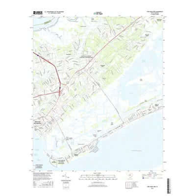
2017 Map of Fort Moultrie
USGS Topo · Published 2017About this map
Fort Sumter National Monument and Fort Moultrie anchor the southern edge of this survey, guarding the entrance to Charleston Harbor. The map reveals a landscape defined by its defensive history and coastal geography, ranging from the colonial legacy of the Charles Pinckney National Historic Site and Palmetto Fort to the modern residential growth of Mount Pleasant. The intricate coastline of Gray Bay and Hamlin Sound is woven together by the Intracoastal Waterway, with the Thompson Memorial Bridge and Ben M Sawyer Memorial Bridge connecting the mainland to the barrier communities of Sullivans Island and the Isle of Palms. Local history is preserved in sites like the Confederate Cem and Venning Cem, while the interior shows the transition from marshlands and creeks like Horlbeck Creek to established neighborhoods and developments.
Find a feature on this map
146 named features on this map. Tap any name to fly to it.
Don’t see what you’re looking for? This feature index may not catch every label — zoom into the map to look around manually.
Map Details
Editions of this 2017 Fort Moultrie Map
This is the sole edition of this map. No revisions or reprints were ever made.
Other maps of this area

1919 · The Jetties
USGS Topo · 1:21,120

1919 · Capers Island
USGS Topo · 1:21,120

1919 · Wando
USGS Topo · 1:21,120

1919 · Melgrove
USGS Topo · 1:21,120

1919 · Charleston
USGS Topo · 1:21,120

1919 · James Island
USGS Topo · 1:21,120

1919 · Fort Moultrie
USGS Topo · 1:21,120

1919 · Sewee Bay
USGS Topo · 1:21,120

1940 · Melgrove
USGS Topo · 1:24,000

1943 · Capers Island
USGS Topo · 1:24,000