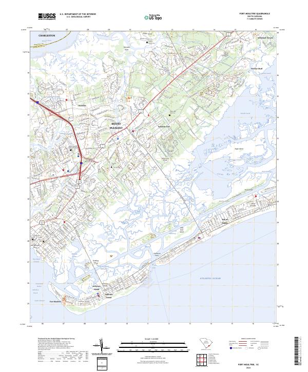
2024 Map of Fort Moultrie
USGS Topo · Published 2024About this map
Fort Moultrie and the Fort Sumter National Monument guard the mouth of the Charleston Harbor, anchoring a landscape defined by the shifting waters of the South Carolina coast. This contemporary survey details the sprawling residential and maritime developments across Mount Pleasant, Sullivans Island, and the Isle of Palms. Genealogy interests are well-served by numerous small burial grounds, including the Confederate Cem and Ocean Grove Cem, as well as the secluded Cook's Old Field Cem. The map tracks the intricate waterways of the Intracoastal Waterway and Gray Bay, alongside cultural landmarks like the Charles Pinckney National Historic Site. From the suburban growth in Snowden to the salt marshes of Copahee Sound, the map captures the modern character of these barrier islands and their historic coastal defenses.
Find a feature on this map
61 named features on this map. Tap any name to fly to it.
Don’t see what you’re looking for? This feature index may not catch every label — zoom into the map to look around manually.
Map Details
Editions of this 2024 Fort Moultrie Map
This is the sole edition of this map. No revisions or reprints were ever made.
Other maps of this area

1919 · The Jetties
USGS Topo · 1:21,120

1919 · Capers Island
USGS Topo · 1:21,120

1919 · Wando
USGS Topo · 1:21,120

1919 · Melgrove
USGS Topo · 1:21,120

1919 · Charleston
USGS Topo · 1:21,120

1919 · James Island
USGS Topo · 1:21,120

1919 · Fort Moultrie
USGS Topo · 1:21,120

1919 · Sewee Bay
USGS Topo · 1:21,120

1940 · Melgrove
USGS Topo · 1:24,000

1943 · Capers Island
USGS Topo · 1:24,000