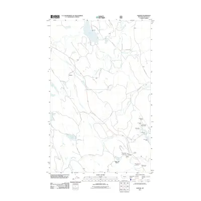
2011 Map of Fortine
USGS Topo · Published 2011About this map
Fortine and the surrounding Lincoln County landscape are defined by the convergence of several major watercourses and the influence of early rail infrastructure. The Tobacco River and Fortine Creek create a complex hydrographic network, supported by several reservoirs including Glen Lake and Crystal Lake, both managed by dams. The small settlement of Tobacco is positioned near the Tobacco Siding, indicating the historical significance of the railroad in this timber-rich region. Local community life is centered around the Fortine Post Office and the Fortine Cemetery, while recreation and small-scale aviation are represented by the Crystal Lake Resort, Vredenberg Airstrip, and the Crystal Lakes Resort Airport. The map also details emergency infrastructure like the Trego - Fortine Stryker Vol Fire Dept Sta 1, reflecting the essential services for these rural Montana townships.
Find a feature on this map
62 named features on this map. Tap any name to fly to it.
Don’t see what you’re looking for? This feature index may not catch every label — zoom into the map to look around manually.
Map Details
Editions of this 2011 Fortine Map
This is the sole edition of this map. No revisions or reprints were ever made.
Other maps of this area

1913 · Stryker
USGS Topo · 1:125,000

1916 · Stryker
USGS Topo · 1:125,000

1957 · Kalispell
USGS Topo · 1:250,000

1960 · Kalispell
USGS Topo · 1:250,000

1961 · Kalispell
USGS Topo · 1:250,000

1963 · Eureka North
USGS Topo · 1:24,000

1963 · Mount Marston
USGS Topo · 1:24,000

1963 · Ksanka Peak
USGS Topo · 1:24,000

1963 · Eureka South
USGS Topo · 1:24,000

1963 · Stryker
USGS Topo · 1:24,000