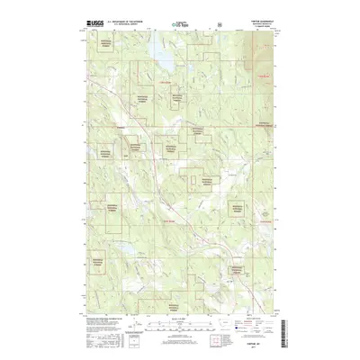
2017 Map of Fortine
USGS Topo · Published 2017About this map
The Kootenai National Forest dominates this section of northwest Montana, where timberlands and mountain ridges frame the drainage of the Tobacco River. The small settlement of Tobacco serves as a historic point of reference near the river's path, while further south, the Fortine Cem provides a tangible link for genealogists researching the families of this forested corridor. This landscape is defined by its water, from the larger Glen Lake and Crystal Lake to the secluded Homes Lake and Barnaby Lake. Modern development is visible at the Crystal Lakes Resort Airport, contrasting with the more primitive networks of the Pomeroy Trl and Fort Steele Trl. The map traces the winding courses of Grave Cr and Fortine Cr, showing a terrain where resource management and recreation have long coexisted along the slopes of Raven's Ridge.
Find a feature on this map
69 named features on this map. Tap any name to fly to it.
Don’t see what you’re looking for? This feature index may not catch every label — zoom into the map to look around manually.
Map Details
Editions of this 2017 Fortine Map
This is the sole edition of this map. No revisions or reprints were ever made.
Other maps of this area

1913 · Stryker
USGS Topo · 1:125,000

1916 · Stryker
USGS Topo · 1:125,000

1957 · Kalispell
USGS Topo · 1:250,000

1960 · Kalispell
USGS Topo · 1:250,000

1961 · Kalispell
USGS Topo · 1:250,000

1963 · Eureka North
USGS Topo · 1:24,000

1963 · Mount Marston
USGS Topo · 1:24,000

1963 · Ksanka Peak
USGS Topo · 1:24,000

1963 · Eureka South
USGS Topo · 1:24,000

1963 · Stryker
USGS Topo · 1:24,000