2024 Map of Fortine
USGS Topo · Published 2024About this map
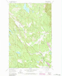
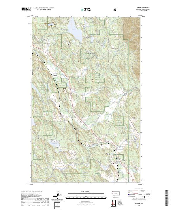
Fortine and the nearby settlement of Tobacco anchor this corner of the Whitefish Range, where the geography is defined by the winding paths of the Tobacco River and Fortine Creek. Much of the landscape is situated within the Kootenai National Forest, showing a network of forest roads and trails like the Fort Steele Trl and Pomeroy Trl that navigate the varied terrain. The map highlights the intersection of local recreation and rural life, featuring Glen Lake and its surrounding park roads alongside aviation facilities at the Crystal Lakes Resort Airport. Local history is anchored at the Fortine Cem, while numerous smaller water bodies such as Barnaby Lake, Lick Lake, and Marl Lake dot the valleys between ridges. The arrangement of trails and access roads reflects the ongoing management of these timberlands and their importance to the local community.
Find a feature on this map
65 named features on this map. Tap any name to fly to it.
Don’t see what you’re looking for? This feature index may not catch every label — zoom into the map to look around manually.
Map Details
Editions of this 2024 Fortine Map
This is the sole edition of this map. No revisions or reprints were ever made.
Historical Maps of Dahlberg Through Time
3 maps found