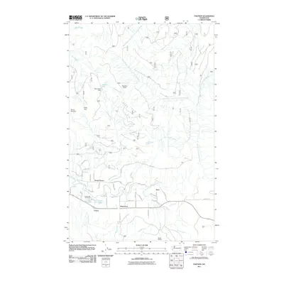
2011 Map of Fortson
USGS Topo · Published 2011About this map
The North Fork Stillaguamish River and its various branches dominate this mountain landscape, carving through the high country around Segelsen Ridge and Round Mountain. The valley floor near the river's bend serves as the primary corridor for human activity, centered around the settlement of Fortson. This area shows the intersection of industry and the natural environment, notably marked by the Fortson Mill Pond, its associated Fortson Mill Pond Dam, and the nearby Fortson Ponds.
Find a feature on this map
41 named features on this map. Tap any name to fly to it.
Don’t see what you’re looking for? This feature index may not catch every label — zoom into the map to look around manually.
Map Details
Editions of this 2011 Fortson Map
This is the sole edition of this map. No revisions or reprints were ever made.
Other maps of this area

1899 · Stillaguamish
USGS Topo · 1:125,000

1901 · Stilaguamish
USGS Topo · 1:125,000

1955 · Concrete
USGS Topo · 1:250,000

1956 · Oso
USGS Topo · 1:62,500

1956 · Granite Falls
USGS Topo · 1:62,500

1957 · Silverton
USGS Topo · 1:62,500

1958 · Concrete
USGS Topo · 1:250,000

1962 · Concrete
USGS Topo · 1:250,000
1966 · Darrington
USGS Topo · 1:24,000
1966 · Fortson
USGS Topo · 1:24,000