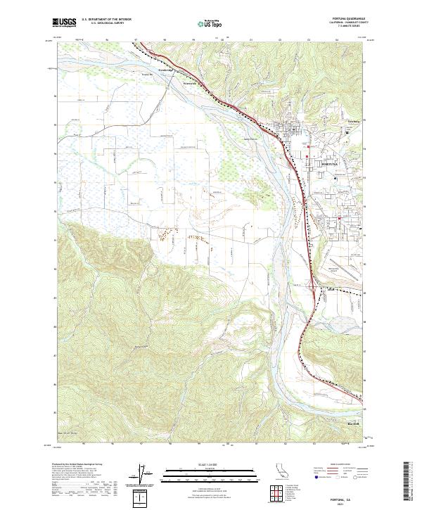
2021 Map of Fortuna
USGS Topo · Published 2021About this map
The Eel River and its expansive floodplain dominate the geography of this part of Humboldt County, creating a wide corridor that has shaped local transportation and settlement. The city of Fortuna is the primary hub, situated near the confluence of Strongs Creek and the main river channel. To the south, the Van Duzen River joins the Eel near the community of Alton, while the northern reach is marked by the historic crossing at Fernbridge. The landscape transitions from the level agricultural flats of Sandy Prairie to the rising elevations of Bear River Ridge and Buzzards Peak. Industrial and transit history is evidenced by the Northwestern Pacific rail line following the river's curve, connecting established settlements like Rio Dell and Worswick with the coast. Local family names and community foundations appear in features such as Sunrise Cemetery and Catholic Cemetery, alongside regional infrastructure like the Rohnerville Airport.
Find a feature on this map
117 named features on this map. Tap any name to fly to it.
Don’t see what you’re looking for? This feature index may not catch every label — zoom into the map to look around manually.
Map Details
Editions of this 2021 Fortuna Map
This is the sole edition of this map. No revisions or reprints were ever made.
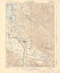
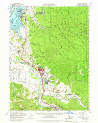
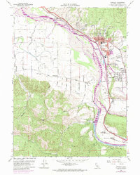
Historical Maps of Alton Through Time
4 maps found