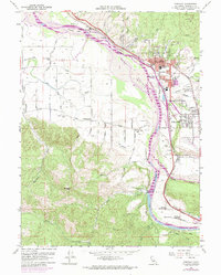
1959 Map of Fortuna
USGS Topo · Published 1974About this map
The Eel River valley dominates this Humboldt County landscape, showing the mid-century agricultural and industrial character of the Eel River Delta area. The Northwestern Pacific railroad runs parallel to the river, connecting key hubs like Fortuna, Alton, and the northern crossing at Fernbridge. A distinctive network of rural schools, including the Grant Union Sch, Grizzly Bluff Sch, and Coffee Creek Sch, reveals the density of the outlying farming communities during the 1950s. The 1972 revisions illustrate urban expansion around Fortuna, particularly the development near the Union High School and Redwood Memorial Hospital. Cultural landmarks such as the St Pius X Seminary and a Drive-in Theater near Rohnerville provide snapshots of local community life. The map also detail topographic features like Buzzards Peak and the expansive gravel reaches of Singley Bar.
Find a feature on this map
47 named features on this map. Tap any name to fly to it.
Don’t see what you’re looking for? This feature index may not catch every label — zoom into the map to look around manually.
Map Details
Editions of this 1959 Fortuna Map
3 editions found
Other maps of this area

1916 · Cape Fortunas
USGS Topo · 1:62,500

1919 · Glynn
USGS Topo · 1:62,500

1921 · Cape Mendocino
USGS Topo · 1:62,500

1943 · Ferndale
USGS Topo · 1:62,500

1944 · Fortuna
USGS Topo · 1:62,500

1949 · Eureka
USGS Topo · 1:250,000

1950 · Cape Mendocino
USGS Topo · 1:62,500

1950 · Scotia
USGS Topo · 1:62,500

1951 · Scotia
USGS Topo · 1:62,500

1951 · Cape Mendocino
USGS Topo · 1:62,500