
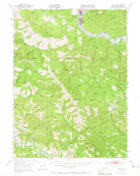
1950 Map of Scotia
USGS Topo · Published 1957About this map
Rio Dell and the lumber town of Scotia anchor this mid-century landscape where industrial transit met the preserved wilderness of Humboldt Redwoods State Park. The Northwestern Pacific railroad follows the winding course of the Eel River, serving as the primary corridor for commerce and travel through the valley. This era reveals a complex network of private holdings and ranching outposts, including McClellan Ranch and Hacketsville, situated along the ridges and creek beds that define the territory between the Eel and the Mattole River.
Find a feature on this map
94 named features on this map. Tap any name to fly to it.
Don’t see what you’re looking for? This feature index may not catch every label — zoom into the map to look around manually.
Map Details
Editions of this 1950 Scotia Map
2 editions found
Other maps of this area

1916 · Cape Fortunas
USGS Topo · 1:62,500

1919 · Glynn
USGS Topo · 1:62,500

1920 · Pt. Delagda
USGS Topo · 1:62,500

1921 · Dyerville
USGS Topo · 1:62,500

1921 · Briceland
USGS Topo · 1:62,500

1921 · Cape Mendocino
USGS Topo · 1:62,500

1922 · Kneeland
USGS Topo · 1:62,500

1926 · Gorda
USGS Topo · 1:62,500

1943 · Ferndale
USGS Topo · 1:62,500

1944 · Fortuna
USGS Topo · 1:62,500