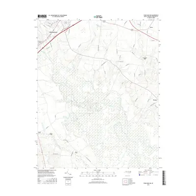
2016 Map of Four Oaks NE
USGS Topo · Published 2016About this map
Smithfield anchors the northwest corner of this Johnston County landscape, where urban street grids transition into a complex network of wetlands and river bends. The Neuse River meanders heavily across the center, creating distinct hydrological features like Quaker Neck Lake and Gav Gut. This 2016 survey documents a rural environment punctuated by small named communities such as Oliver and Brogden, alongside agricultural landmarks like Creeches Mill. The infrastructure reflects the terrain’s challenges, with several crossings including Barefoot Bridge, Rhodes Bridge, and Sanders Bridge spanning the river and its southern tributaries. Local geography is further defined by smaller water bodies like Cogdells Pond and Polecat Br, while Hills of Neuse Memorial Gardens stands as a notable landmark near the city limits.
Find a feature on this map
67 named features on this map. Tap any name to fly to it.
Don’t see what you’re looking for? This feature index may not catch every label — zoom into the map to look around manually.
Map Details
Editions of this 2016 Four Oaks NE Map
This is the sole edition of this map. No revisions or reprints were ever made.
Other maps of this area

1902 · Kenly
USGS Topo · 1:62,500

1903 · Kenly
USGS Topo · 1:62,500

1906 · Four Oaks
USGS Topo · 1:48,000

1908 · Four Oaks
USGS Topo · 1:62,500

1953 · Raleigh
USGS Topo · 1:250,000

1954 · Raleigh
USGS Topo · 1:250,000

1964 · Selma
USGS Topo · 1:62,500

1964 · Powhatan
USGS Topo · 1:24,000

1964 · Selma
USGS Topo · 1:24,000

1974 · Grantham
USGS Topo · 1:24,000