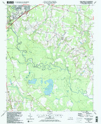
1986 Map of Four Oaks NE
USGS Topo · Published 1986About this map
The Neuse River meanders through the heart of this Johnston County landscape, defining a terrain of winding tributaries and low-lying wetlands. In the northwest, the city of Smithfield sits at a critical junction where the Seaboard railroad and major roads cross the water. The surrounding countryside is dotted with small rural landmarks, including a high concentration of community centers such as Stewart Chapel, Hickory Grove Ch, and Sanders Chapel.
Find a feature on this map
32 named features on this map. Tap any name to fly to it.
Don’t see what you’re looking for? This feature index may not catch every label — zoom into the map to look around manually.
Map Details
Editions of this 1986 Four Oaks NE Map
This is the sole edition of this map. No revisions or reprints were ever made.
Other maps of this area

1902 · Kenly
USGS Topo · 1:62,500

1903 · Kenly
USGS Topo · 1:62,500

1906 · Four Oaks
USGS Topo · 1:48,000

1908 · Four Oaks
USGS Topo · 1:62,500

1953 · Raleigh
USGS Topo · 1:250,000

1954 · Raleigh
USGS Topo · 1:250,000

1964 · Selma
USGS Topo · 1:62,500

1964 · Powhatan
USGS Topo · 1:24,000

1964 · Selma
USGS Topo · 1:24,000

1974 · Grantham
USGS Topo · 1:24,000