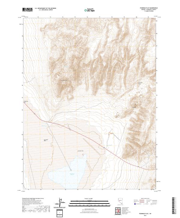
2021 Map of Fourmile Flat
USGS Topo · Published 2021About this map
Salt Wells Marsh and the expansive Fourmile Flat dominate this desert landscape, illustrating the terminal drainage patterns of Churchill County. The terrain transitions from the low-lying Salt Wells Basin to the prominent heights of the Stillwater Range, where Pony Bob Peak serves as a significant landmark. The presence of Sand Mountain highlights the eolian processes active in the region, creating a distinctive contrast with the nearby playas.
Find a feature on this map
17 named features on this map. Tap any name to fly to it.
Don’t see what you’re looking for? This feature index may not catch every label — zoom into the map to look around manually.
Map Details
Editions of this 2021 Fourmile Flat Map
This is the sole edition of this map. No revisions or reprints were ever made.
Other maps of this area

1908 · Carson Sink
USGS Topo · 1:250,000

1910 · Carson Sink
USGS Topo · 1:250,000

1951 · Carson Lake
USGS Topo · 1:62,500

1951 · Allen Springs
USGS Topo · 1:62,500

1957 · Reno
USGS Topo · 1:250,000

1959 · Reno
USGS Topo · 1:250,000

1960 · Reno
USGS Topo · 1:250,000

1972 · Fourmile Flat
USGS Topo · 1:24,000

1972 · Diamond Canyon
USGS Topo · 1:24,000
1972 · Frenchman
USGS Topo · 1:24,000