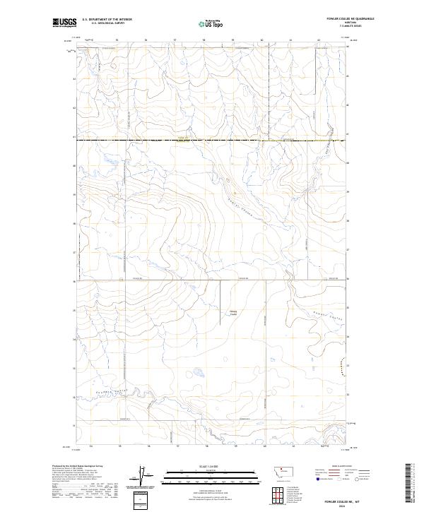
2024 Map of Fowler Coulee NE
USGS Topo · Published 2024About this map
St Olaf Church stands as a focal point near the northern border of this Montana landscape, where the plains are etched by a series of drainage coulees. The terrain is defined by the winding paths of Fowler Coulee and Floberg Coulee, which cut through the high prairie between Toole and Pondera Counties. The distribution of section lines and gravel roads reveals a deeply rooted rural infrastructure, with routes like S Central School Rd and Christenson School Rd N pointing toward the historic locations of former country schools. This 2024 survey documents the enduring grid of large-scale agriculture, where family-named thoroughfares such as Larry Bird Rd, Preputin Rd, and Julson Rd connect isolated farmsteads across the wide northern Montana benchlands.
Find a feature on this map
26 named features on this map. Tap any name to fly to it.
Don’t see what you’re looking for? This feature index may not catch every label — zoom into the map to look around manually.
Map Details
Editions of this 2024 Fowler Coulee NE Map
This is the sole edition of this map. No revisions or reprints were ever made.
Other maps of this area

1920 · Conrad
USGS Topo · 1:125,000

1954 · Shelby
USGS Topo · 1:250,000

1958 · Shelby
USGS Topo · 1:250,000

1967 · Central School
USGS Topo · 1:24,000

1967 · Conrad Butte
USGS Topo · 1:24,000

1967 · Fowler Coulee SW
USGS Topo · 1:24,000

1967 · Fowler Coulee NW
USGS Topo · 1:24,000
1967 · Fowler Coulee SE
USGS Topo · 1:24,000
1967 · Fowler Coulee NE
USGS Topo · 1:24,000

1970 · Sollid School
USGS Topo · 1:24,000