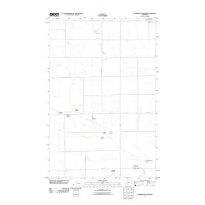
2011 Map of Fowler Coulee NW
USGS Topo · Published 2011About this map
Pondera County land patterns are defined by an intricate network of drainage coulees and agricultural water management in this 2011 survey. The northern edge features the St Olaf Church landmark and the M Ratzburg Reservoir, while the rest of the landscape is marked by numerous family-named irrigation and stock dams, including Dato Dam, Harold Phillips Dam, and the Bergstroms Farms Dam complex. This reliance on localized water storage highlights the vital role of private engineering in sustaining the high plains farming economy. A rectilinear grid of rural roads, such as Mountain School Rd and Sollid Rd, carves through the terrain, crossing numerous natural drainage features like Wilcox Coulee, Bird Coulee, and South Pondera Coulee, illustrating the challenges of navigating this seasonally watered environment.
Find a feature on this map
26 named features on this map. Tap any name to fly to it.
Don’t see what you’re looking for? This feature index may not catch every label — zoom into the map to look around manually.
Map Details
Editions of this 2011 Fowler Coulee NW Map
This is the sole edition of this map. No revisions or reprints were ever made.
Other maps of this area

1920 · Conrad
USGS Topo · 1:125,000

1954 · Shelby
USGS Topo · 1:250,000

1958 · Shelby
USGS Topo · 1:250,000

1967 · Central School
USGS Topo · 1:24,000

1967 · Conrad Butte
USGS Topo · 1:24,000

1967 · Brady
USGS Topo · 1:24,000

1967 · Fowler Coulee SW
USGS Topo · 1:24,000

1967 · Fowler Coulee NW
USGS Topo · 1:24,000
1967 · Letz Lake
USGS Topo · 1:24,000
1967 · Fowler Coulee SE
USGS Topo · 1:24,000