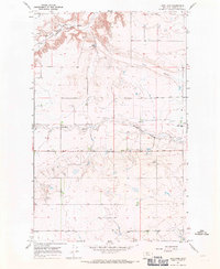
1967 Map of Letz Lake
USGS Topo · Published 1971About this map
The Marias River carves a deep valley across this Pondera County landscape, where the Great Northern railroad tracks trace the northern banks and pass several Gravel Pits. This late 1960s terrain is defined by its drainage network, featuring Dry Fork, Pondera Coulee, and Favot Coulee winding through the plains. Local infrastructure is concentrated along rural thoroughfares like Sollid Road and Midway Road, supporting a sparse settlement pattern of isolated farmsteads and rural landmarks.
Find a feature on this map
13 named features on this map. Tap any name to fly to it.
Don’t see what you’re looking for? This feature index may not catch every label — zoom into the map to look around manually.
Map Details
Editions of this 1967 Letz Lake Map
This is the sole edition of this map. No revisions or reprints were ever made.
Other maps of this area

1920 · Conrad
USGS Topo · 1:125,000

1954 · Shelby
USGS Topo · 1:250,000

1958 · Shelby
USGS Topo · 1:250,000
1967 · Conrad
USGS Topo · 1:24,000

1967 · Conrad Butte
USGS Topo · 1:24,000

1967 · Brady
USGS Topo · 1:24,000

1967 · Fowler Coulee SW
USGS Topo · 1:24,000
1967 · Pioneer School
USGS Topo · 1:24,000

1967 · Fowler Coulee NW
USGS Topo · 1:24,000
1967 · Conrad SW
USGS Topo · 1:24,000