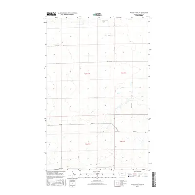
2017 Map of Fowler Coulee SW
USGS Topo · Published 2017About this map
South Pondera Coulee and the meandering path of Snake Cr define this rural landscape in Pondera County, Montana. The map illustrates a highly organized grid of range and township lines, characteristic of the state's agricultural high plains. This 2017 data reflects a region dominated by large-scale land management, where local travel relies on a network of named section roads. For researchers, the map provides a look at the specific naming conventions of these thoroughfares, from the northern Fox Ln and Berland Loop down to Armstrong Rd along the southern boundary. The intersection of local infrastructure is evident where Brady Rd cuts across the lower townships, connecting various drainage features like Rock Coulee Rd.
Find a feature on this map
21 named features on this map. Tap any name to fly to it.
Don’t see what you’re looking for? This feature index may not catch every label — zoom into the map to look around manually.
Map Details
Editions of this 2017 Fowler Coulee SW Map
This is the sole edition of this map. No revisions or reprints were ever made.
Other maps of this area

1886 · Great Falls
USGS Topo · 1:250,000

1920 · Conrad
USGS Topo · 1:125,000

1950 · Dutton
USGS Topo · 1:62,500

1950 · Collins
USGS Topo · 1:62,500

1954 · Great Falls
USGS Topo · 1:250,000

1954 · Shelby
USGS Topo · 1:250,000

1957 · Great Falls
USGS Topo · 1:250,000

1958 · Shelby
USGS Topo · 1:250,000

1967 · Brady
USGS Topo · 1:24,000

1967 · Fowler Coulee SW
USGS Topo · 1:24,000