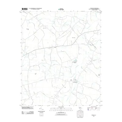
2011 Map of Fowler
USGS Topo · Published 2011About this map
Fowler and the surrounding Williamsburg County lowlands are defined by an intricate network of wetlands and drainage basins in this 2011 survey. The landscape is characterized by numerous "bays"—distinctive elliptical depressions such as Whiteoak Bay, McCants Bay, and Pine Island Bay—which intersperse with slow-moving watercourses like Whiteoak Swamp and Home Swamp. These natural features have historically dictated the placement of roads and small settlements, creating a pattern of dispersed rural living.
Find a feature on this map
58 named features on this map. Tap any name to fly to it.
Don’t see what you’re looking for? This feature index may not catch every label — zoom into the map to look around manually.
Map Details
Editions of this 2011 Fowler Map
This is the sole edition of this map. No revisions or reprints were ever made.
Other maps of this area

1946 · Hyman
USGS Topo · 1:62,500

1946 · Kingstree
USGS Topo · 1:62,500

1946 · Lake City
USGS Topo · 1:62,500

1946 · Indiantown
USGS Topo · 1:62,500

1949 · Georgetown
USGS Topo · 1:250,000

1967 · Georgetown
USGS Topo · 1:250,000

1974 · Georgetown
USGS Topo · 1:250,000

1986 · Kingstree
USGS Topo · 1:100,000
1990 · Lake City East
USGS Topo · 1:24,000
1990 · Indiantown
USGS Topo · 1:24,000