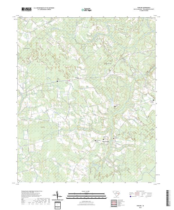
2024 Map of Fowler
USGS Topo · Published 2024About this map
Fowler sits at the heart of this coastal plain landscape, where the geography is defined by an intricate network of wetlands and family-centered landmarks. The area is heavily intersected by named swamps, including Whiteoak Swamp, Home Swamp, and McKnight Swamp, which weave between distinct bays such as Whiteoak Bay and Round Bay. This drainage pattern created a unique distribution of high ground where rural settlements and agricultural fields could take hold.
Find a feature on this map
68 named features on this map. Tap any name to fly to it.
Don’t see what you’re looking for? This feature index may not catch every label — zoom into the map to look around manually.
Map Details
Editions of this 2024 Fowler Map
This is the sole edition of this map. No revisions or reprints were ever made.
Other maps of this area

1946 · Hyman
USGS Topo · 1:62,500

1946 · Kingstree
USGS Topo · 1:62,500

1946 · Lake City
USGS Topo · 1:62,500

1946 · Indiantown
USGS Topo · 1:62,500

1949 · Georgetown
USGS Topo · 1:250,000

1967 · Georgetown
USGS Topo · 1:250,000

1974 · Georgetown
USGS Topo · 1:250,000

1986 · Kingstree
USGS Topo · 1:100,000
1990 · Lake City East
USGS Topo · 1:24,000
1990 · Indiantown
USGS Topo · 1:24,000