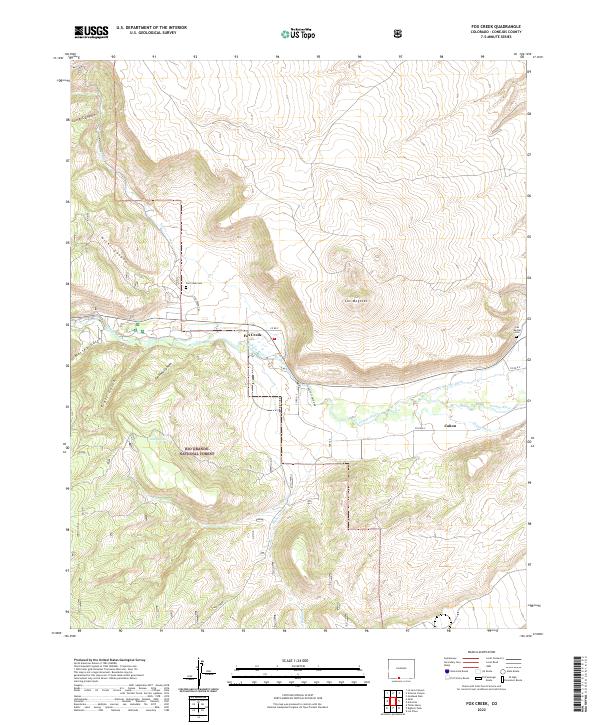
2022 Map of Fox Creek
USGS Topo · Published 2022About this map
The Conejos River valley serves as a central artery through this portion of Colorado, where the transition from high-elevation canyons to agricultural bottomlands is clearly defined by irrigation infrastructure. The lower elevations near Cañon are crisscrossed by the Las Mesitas Ditch and Cañon Ditch, illustrating the area's long-standing reliance on managed water systems. Higher in the drainage, the settlement of Fox Creek sits at the doorstep of the Rio Grande National Forest, where the terrain rises sharply into named features like Los Mogotes. This landscape is marked by several historical intersections of travel and burial, including the Fox Creek Cem and Las Mesitas Cem, alongside the Osier railroad site. The network of canyons, such as Conoboy Canyon and Hicks Canyon, suggests a geographic isolation that has preserved the footprint of early ranching and forestry efforts.
Find a feature on this map
31 named features on this map. Tap any name to fly to it.
Don’t see what you’re looking for? This feature index may not catch every label — zoom into the map to look around manually.
Map Details
Editions of this 2022 Fox Creek Map
This is the sole edition of this map. No revisions or reprints were ever made.
Other maps of this area

1918 · Tusas
USGS Topo · 1:125,000

1922 · Conejos
USGS Topo · 1:125,000

1945 · Durango
USGS Topo · 1:250,000

1953 · Durango
USGS Topo · 1:250,000

1954 · Durango
USGS Topo · 1:250,000

1954 · Aztec
USGS Topo · 1:250,000

1955 · Brazos Peak
USGS Topo · 1:62,500

1958 · Aztec
USGS Topo · 1:250,000

1961 · Durango
USGS Topo · 1:250,000

1962 · Aztec
USGS Topo · 1:250,000