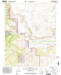
2001 Map of Fox Creek
USGS Topo · Published 2005About this map
Rio Grande National Forest dominates the western half of this landscape, where the terrain transitions from high plateaus down into the fertile valley of the Conejos River. The settlement of Fox Creek sits tucked along the forest boundary, served by its namesake Fox Creek Cem. To the southeast, the village of Cañon and the nearby Las Mesitas Ch reflect the agricultural heritage of the high desert, supported by a system of irrigation including the Las Mesitas Ditch and Cañon Ditch.
Find a feature on this map
32 named features on this map. Tap any name to fly to it.
Don’t see what you’re looking for? This feature index may not catch every label — zoom into the map to look around manually.
Map Details
Editions of this 2001 Fox Creek Map
This is the sole edition of this map. No revisions or reprints were ever made.
Other maps of this area

1918 · Tusas
USGS Topo · 1:125,000

1922 · Conejos
USGS Topo · 1:125,000

1945 · Durango
USGS Topo · 1:250,000

1953 · Durango
USGS Topo · 1:250,000

1954 · Durango
USGS Topo · 1:250,000

1954 · Aztec
USGS Topo · 1:250,000

1955 · Brazos Peak
USGS Topo · 1:62,500

1958 · Aztec
USGS Topo · 1:250,000

1961 · Durango
USGS Topo · 1:250,000

1962 · Aztec
USGS Topo · 1:250,000